Login

russian armor

(2) Winnkendonk w/ historic background

31 Mar 2017, 19:19 PM
#1
avatar of Siphon X.
Senior Editor Badge

Posts: 1138 | Subs: 2

So, finally got my first map to reasonably finished state:

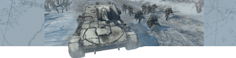
(2) Fields of Winnekendonk

Thanks for the help guys!

The map attempts to depict the settings that be British encountered just north outside of Winnekendonk the 2nd of March, 1945. The fight that ensued seems to be rather typical for several engagements during the operations Vertitable and Blockbuster. There wasn’t anything special about the events, I just happen to be raised in Winnekendonk, so…


British combat group at the northeastern edge of Kervenheim.

The image above gives some idea about how the area looked like at the time: It’s pretty flat and open. No snow but very muddy ground and an overcast sky.

Historical background


After taking Goch, the 2nd Canadian Corps was supposed to push through the Hochwald area and ultimately towards the Rhine at Wesel. The British XXX Corps was tasked to secure the right flank of the Canadians. After heavy fights in the triangle Goch-Weeze-Uedem, the 3rd British Division was to secure the villages of Kervenheim and Winnekendonk.

At this stage, the goal of the German defenders was merely to delay the allied advance in order to allow the troops a retreat to the bridgehead at Wesel.

On the 28th of February 1945, the British troops approached Kervenheim which was defended by elements of the 8th Fallschirmjäger division. The about 200 Jägers managed to delay the superior allied forces by two days before withdrawing towards Winnekendonk.

In preparation of operation Veritable, Winnekendonk was subject to a minor air raid on the 16th of February and then was heavily bombed on the 28th.

2nd of March, 1945
The following is a translation of the description found in “Der zweite Weltkrieg zwischen Rhein und Maas“ by Heinz Bosch.


[The farmer living at the Roghmannshof notes for the 2nd of March:] ”The last soldiers arriving here [after retreating from Kervenheim] didn’t look human anymore. They were dirty, tired, hungry and unshaved. The behaved accordingly. 40 men were supposed to dig in here to delay the enemy. They took up positions in the house and behind hedgerows. At the request of the Fallschirmjägers we hid in the basement. The street […] was blown up. We could hear the noise of artillery barrages and the MGs. The group of Fallschirmjägers then retreated towards the Plockhorsthof.”

[…]

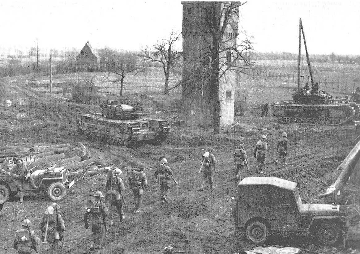
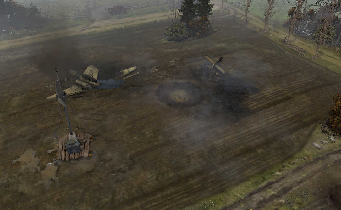
The 9th Brigade, supported by the Ulster Rifles and the 3rd tank battalion of the Scots Guards reached the northeastern edge of Winnekendonk on the 2nd of May at about 3PM. In the fire of the Typhoons, the last pockets of resistance in the Berberheide were abandoned by the Germans.
The British were met with sudden defensive fire from positions at van de Flierdt, Büllhorsthof, Plockhorsthof and from the Kevelaerer Straße at Stammen. Under tank cover, the Lincoln’s infantry approached across the open ground and trickled into the northern part of Winnekendonk. The street from Kervenheim to Winnekendonk was blown up at several places to make it unusable.
Two English tanks exploded after several heavy hits. A German assault gun at Stammen was taken out by a direct hit. Another one picked up the partly wounded crew and withdrew towards Kevelaer and […] ran over a mine. […]

The fights lasted until nightfall. While Fallschirmjägers still fired their MGs at approaching infantry from the roof of Büllhorsthof, the first English entered the building below. Several tanks surrounded the farm, one of which being so close that its barrel reached into the entrance. The Fallschirmjäger were ultimately defeated in a close-quarters fight.
Fortunately, all 36 civilians that took refuge on the farm were unharmed. […] Corpses of fallen Jägers, English soldiers and civilians were scattered in the surrounding gardens. In midst of the fray a son was born to van de Flierdt’s.

In the following night, artillery shells continuously detonated in the devastated village. On the morning of the 3rd of March 50 to 60 tanks moved into the center of Winnekendonk. The following infantry found no resistance in the ruins. […] In the basements of the destroyed houses the Lincolns rounded up 200 demoralized German soldiers which were taken prisoner.
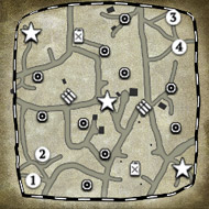
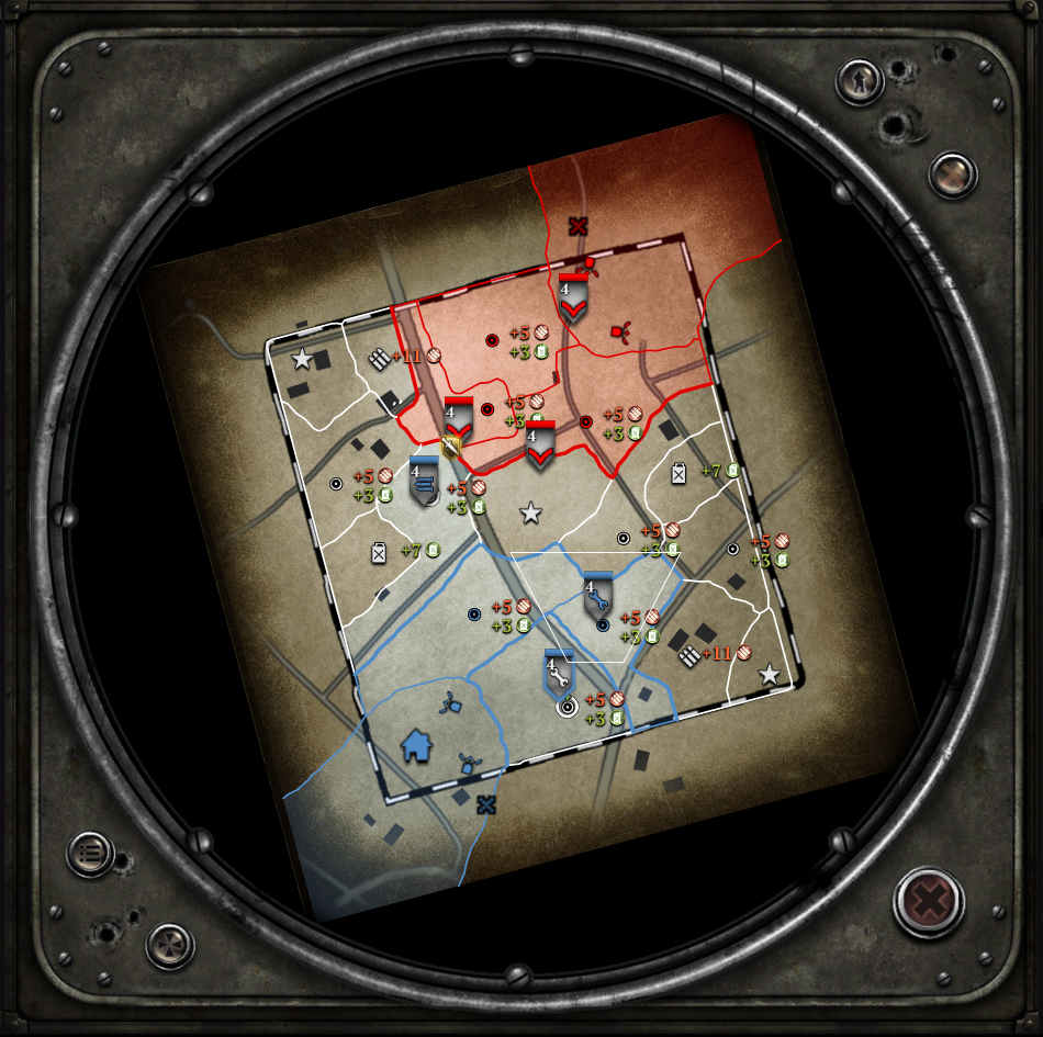
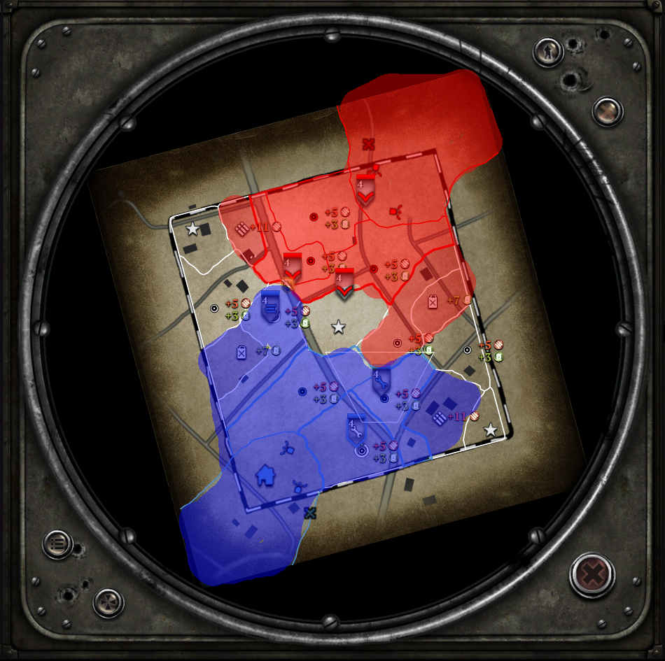
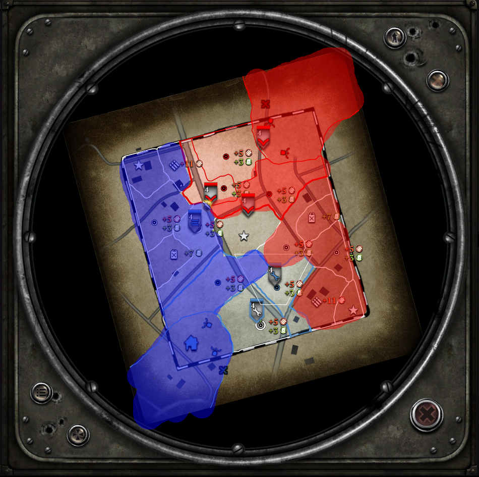

Map Overview


The image above shows the map with some annotations. The orientation is more or less with the top being North. Winnekendonk proper is on the lower boundary. The forest in the northestern corner is the Berberheide. The white text denotes the names of the farms (“Hof” means “farm”) or families that lived there. Street names (=”Straße”) are denoted in pink. The yellow letters indicate the cities or villages that the streets lead to.

Modern day Winnekendonk is significantly bigger than it was back then. Nowadays, the area north of Kevelaerer Straße is built up. E.g. my parent’s house is on the “Hoher Weg” (literally “High Way” not because it is a main street, but rather because it is actually higher than the surrounding fields because clay for bricks was dug up there), a bit further north than the southern base.
Also, a new “Hestert” street was built, starting on the Kervenheimer Straße at “Brönkshof” leading East along the route indicated by the field paths on the map.

The arrows denote (roughly) the view depicted in the photographs and screenshots below (click to enlarge). The colored photos were taken on the 3rd of March 2017, so to the day 62 years after Winnekendonk was finally secured by the British.

1: Shed in the field as viewed from the Hoher Weg with the Brönkshof in the background.

2: Kervenheimer Straße

3: Main street

4: Büllhorsthof

5: View from Kervenheimer Straße towards Berberheide

6: View from Hestert towards Berberheide


Map design


Visuals
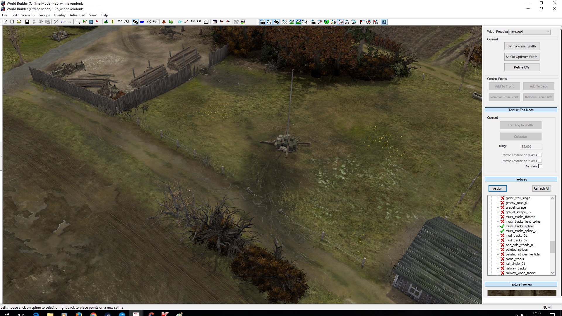
The area is recreated roughly at a 3:1 scale. This also means that the farms and the roads are larger than in reality, which also means that I couldn’t really recreate the original layouts of the farm buildings. This would have been tricky anyways due to the limited amount of types of houses available in the world builder (in particular there are no brick-built farmhouses).

Brönkshof (center) and Roghmannshofs (upper left hand corner). The ditch snaking around the NW corner represents the Brönksley, a tiny creek that starts in the map area.


In terms of landscape I made an attempt to recreate the visuals of the area along the lower Rhineland which so far haven't been depicted well (at least from what I’ve seen): For starters, there are no real hills, with the exception of a few moraines like the ridge that features the well-known Hochwald gap. And there are certainly no outcropping rocks. It’s basically all sand and mud, mostly fields with a few patches of forest.

In order to allow for the typical long viewlines, I ended up with a probably unusually large “playable area”. Yet, I still needed to add some fog so that the edges of the map wouldn’t be overly obvious.

I couldn’t find historic aerial photographies, so don’t actually know how the layout of the fields was. It is likely, though that they probably would have looked similar to how they looked today, only subdivided into smaller units and with more bushes and trees on the edges.
Yet, in particular the German position at Stammen’s indicates that the area was probably more open than it is on the map.

Vegetation also turned out to be a bit tricky: The winter versions of most trees/bushes are snow covered, but there was no snow as the historic pictures above show. Instead it was rather wet, to the point where using tanks was tricky as they got bogged down in the mud. So, I ended up using the few leaf- and snowless trees together with fall versions (there are a few trees that actually do keep their brown leaves) or green types for evergreens.

Gameplay
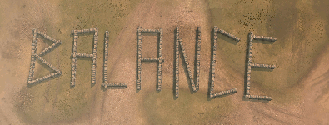
It was clear that the scenario would result in a fairly open map. To balance that, the farm houses at the edges produce some close-quarter dominated areas. Generally, there isn’t a lot of green cover, but lots of yellow cover.


The open, central area doesn’t contain a lot of resources, but allows the player controlling it to put pressure on the munition points and the fuel cut-offs. In that way, the sector layout is a variation of what you have on Arnhem Checkpoint. However, there are several routes to flank the positions in the center, in particular the two fuel cut-offs.

There are a lot of fences, so vaulting helps. However, I broke them up at strategic points to allow for reasonable retreats. The street results in some red cover, but again the Germans conveniently blew it up (giving yellow cover) where retreats or attacks are likely to happen.

Otherwise I attempted to keep features more or less symmetric, albeit by different means: E.g., while there is a trench providing yellow cover in front of the western cut-off, there are craters in the same role for the eastern one.

Happy about any feedback!
2 Apr 2017, 20:36 PM
#2
avatar of Tric
Master Mapmaker Badge

Posts: 1466 | Subs: 4

I'll post feedback in a few day(s), dl'd the map, and it isn't bad for a first one, but it has a lot of issues too. Will give a full list when I get a moment.
2 Apr 2017, 21:27 PM
#3
avatar of ZombiFrancis

Posts: 2742

Excellent map! I love these types of maps that actually attempt to replicate real world places.

The biggest thing I can say for the map gameplay wise concern territory sectors.

I do like how the cutoffs to the fuel work, but the map may not be as dynamic as a result. (That said, Semois was one of the most popular vCoH maps and likewise not nearly as dynamic as, say, Langres. This isn't necessarily a bad thing.)

Suggestion for an alternate territory layout:


Essentially features a harsher cutoff and with more contestable munitions. It may even be less dynamic that what you have currently, but it could work well considering the map is so open.

Great efforts so far!
4 Apr 2017, 07:32 AM
#4
avatar of Siphon X.
Senior Editor Badge

Posts: 1138 | Subs: 2


Essentially features a harsher cutoff and with more contestable munitions. It may even be less dynamic that what you have currently, but it could work well considering the map is so open.


Thanks for the feedback.

Yeah, good suggestion to move the munitions further to the edges. Makes them easier to get for the other player and also adds more value to the territory points west of Brönkshof and East of Büllhorsthof.

I'll have to check how the setting around those points will play out as it is currently rather different. E.g. the main building of Büllhorsthof is pretty dominant in the area right now, which currently is ok I guess as it doesn't protect anything important. And bumping up the strength of the stone shed on Brönkshof to a similar level will probably favor the southern player too much. I'll have a look into that...

Wondering, why would you think this change could make it play less dynamic? Like, I would think that more incentive to hold points away from the center would actually increase the dynamics, no?


jump backJump back to quoted post2 Apr 2017, 20:36 PMTric
I'll post feedback in a few day(s), dl'd the map, and it isn't bad for a first one, but it has a lot of issues too. Will give a full list when I get a moment.


Looking forward to it :)

4 Apr 2017, 20:23 PM
#5
avatar of ZombiFrancis

Posts: 2742

What I mean by a map not being so dynamic really just has to do with how possible it is for each player to capture different portions of the map.

For instance angoville allows both players to effectively push either left or right side. The sides of the maps often change hands, and engagements often spread out to the flanks of crucial points.

A map like minsk pocket on the other hand mostly allocates each player a half of the map. A central vp and/or a cutoff becomes the focus of pushing for each player.

This isn't a bad thing necessarily, but it makes it especially important to ensure the sides are balanced
5 Apr 2017, 22:10 PM
#6
avatar of Siphon X.
Senior Editor Badge

Posts: 1138 | Subs: 2

What I mean by a map not being so dynamic really just has to do with how possible it is for each player to capture different portions of the map.

For instance angoville allows both players to effectively push either left or right side. The sides of the maps often change hands, and engagements often spread out to the flanks of crucial points.

A map like minsk pocket on the other hand mostly allocates each player a half of the map. A central vp and/or a cutoff becomes the focus of pushing for each player.

This isn't a bad thing necessarily, but it makes it especially important to ensure the sides are balanced


I see, yeah.

Updated the map now, I moved the sectors around like this:


Also added more splats to the ditches, reduced the health of the main building at Roghmannshof and moved stuff on the farms around to make pathfinding for light vehicles easier.

I'm wondering how the munitions points will play out...

If both players go for the nearest points, the map will be divided up something like this:


However, the downside is that you need to defend pretty much every point along the front because each of the sectors there is more or less a cutoff. Also, the muni and fuel-points are pretty far aways from each other, so not easy to defend. However, it naturally easier to put pressure on the opponent's cutoff from this position.

Alternatively, the split might be


The muni points are a little farther away from the bases this way, but the the frontline is more compact...


6 Apr 2017, 03:22 AM
#7
avatar of ZombiFrancis

Posts: 2742

Very nice, I like it. Excellent work so far!

I too am curious as to how those muni points will play out. I'll have to play some rounds this weekend on it and see!
12 Apr 2017, 23:56 PM
#8
avatar of Tric
Master Mapmaker Badge

Posts: 1466 | Subs: 4

I have been very busy, sorry the feedback is taking longer than expected.
18 Apr 2017, 08:30 AM
#9
avatar of Siphon X.
Senior Editor Badge

Posts: 1138 | Subs: 2

jump backJump back to quoted post12 Apr 2017, 23:56 PMTric
I have been very busy, sorry the feedback is taking longer than expected.


No worries, I was kind of busy lately as well :)
18 Apr 2017, 13:33 PM
#10
avatar of beagletank

Posts: 37

Hi Siphon X.,

nice work so far, I love authentic maps. I am not good at improving sectors, but I might help you updating the look of your map. People who are new to the world builder often underestimate the power of splats, especially when it comes to the colour and opacity editor.

Winnekendonk has the right look, but most of it´s fields are too clean. Just add a few splats and splines and everything should be fine. :thumb:


19 Apr 2017, 17:57 PM
#11
avatar of Siphon X.
Senior Editor Badge

Posts: 1138 | Subs: 2

Hi Siphon X.,

nice work so far, I love authentic maps. I am not good at improving sectors, but I might help you updating the look of your map. People who are new to the world builder often underestimate the power of splats, especially when it comes to the colour and opacity editor.

Winnekendonk has the right look, but most of it´s fields are too clean. Just add a few splats and splines and everything should be fine.


Thanks Beagletank,

ok, I added a lot more splines now and some other embellishments. I didn't want to go totally overboard, though, as this should still look like an area that is heavily farmed. And actual fields that are in use do tend to look boring...

Anyways, with the new splines and splats the muddy fields now look even more muddy and the grassland has more texture to it. Plus a lot of other splats and a few more details here and there... (I guess you'll tell me you want moar! ;) )

Also, remodeled the central field: Instead of a lone Sherman wreck it now features a crashed Stuka, which makes the area visually more interesting and also the cover situation around the central point is fairly symmetric now.

Edit: I figure one reason why some of the puddles don't have a lot of reflections is that I put the sun basically behind the player (I tried to keep the map more or less with real world North up and the sun roughly where it would have been around when the attack happened).
20 Apr 2017, 17:02 PM
#12
avatar of ZombiFrancis

Posts: 2742

I'd be careful though with the crashed stuka objects. They have odd shot blocking and movement blocking areas.

Vcoh had such a better selection of objects to use...
21 Apr 2017, 07:34 AM
#13
avatar of Siphon X.
Senior Editor Badge

Posts: 1138 | Subs: 2

I'd be careful though with the crashed stuka objects. They have odd shot blocking and movement blocking areas.

Vcoh had such a better selection of objects to use...


Yeah, I noticed that the "stuka_debris" object blocks a really large field with only a few, small objects. Since that would look kind of stupid, I didn't use that one.

The front part of the Stuka has a rectangular shape as well (unlike the actual model), but I tried to solve that inconsistency by putting an Earth mound in that area (as if it was dug up by the crash), so it looks as if the infantry takes cover behind the mound rather than the actual wreck.

Ok, granted, it's a big odd that the "cover from the mound" disappears when the wreck is crushed, but I doubt that players would notice this much...

Here is how this looks like now:


(The Stuka fuselage and wings mimic the cover produced by the haystack and cart just south of the image, the crater relates to the ditch to the west and the tail section is in the same spot as the destroyed truck on the road on the other side).
1 user is browsing this thread: 1 guest

Ladders Top 10

  • #
    Steam Alias
    W
    L
    %
    Streak
Data provided by Relic Relic Entertainment

Replay highlight

VS
  • U.S. Forces flag cblanco ★
  • The British Forces flag 보드카 중대
  • Oberkommando West flag VonManteuffel
  • Ostheer flag Heartless Jäger
uploaded by XXxxHeartlessxxXX

Board Info

527 users are online: 3 members and 524 guests
cammilo, shinasukac, Kieselberg
18 posts in the last 24h
44 posts in the last week
100 posts in the last month
Registered members: 44647
Welcome our newest member, Vassarh9
Most online: 2043 users on 29 Oct 2023, 01:04 AM